Extreme Weather
1. This question has 3 part(s).
1.1. The Saffir-Simpson Scale measures the magnitude of tropical cyclones.
Identify one source of data used to calculate the Saffir-Simpson Scale of a tropical cyclone.
(1)
A | satellite imagery |
B | seismometer readings |
C | recorded wind speeds |
D | thermometer readings |
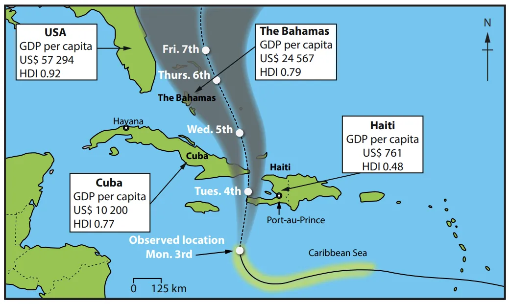
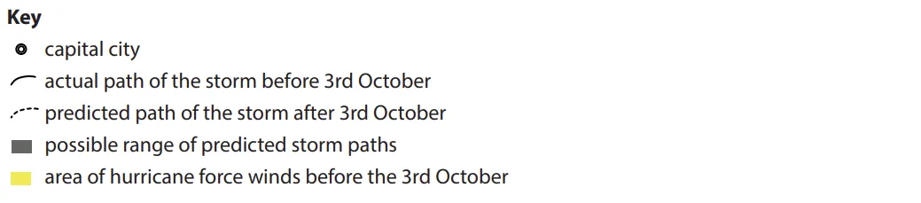
1.2. Study Figure 3.
USA | Haiti | The Bahamas | |
Total Deaths | 33 | 1 027 | 27 |
GDP per Capita (US$) | 57 294 | 761 | 24 567 |
HDI (Human Development Index) | 0.92 | 0.48 | 0.79 |
Figure 3
Actual and predicted path of Hurricane Matthew (Oct 2016) and data for selected countries
i)
Haiti appears to be very vulnerable to the impacts of Hurricane Matthew. Using Figure 3, suggest two reasons why.
(4)
ii)
Figure 3 includes a GIS cyclone track map. Explain two ways maps such as these can help countries to prepare for tropical cyclones.
(4)
1.3. Evaluate the effectiveness of the methods of response to a tropical cyclone in a named developed country.
Named developed country ............................................................

Ai এর মাধ্যমে

১০ লক্ষ+ প্রশ্ন ডাটাবেজ

প্র্যাকটিস এর মাধ্যমে নিজেকে তৈরি করে ফেলো
উত্তর দিবে তোমার বই থেকে ও তোমার মত করে।

সারা দেশের শিক্ষার্থীদের মধ্যে নিজের অবস্থান যাচাই
No related questions found